Mapping out history of Hexi Corridor for future
2025-03-10 12:53 China Daily Global
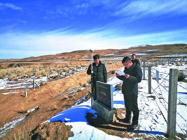
Using survey tools, workers of the fourth national cultural relics census check and gather data for the immovable cultural relics in Zhangye, Gansu province.[Photo provided to China Daily]
In a significant stride toward heritage preservation, Zhangye in Northwest China's Gansu province has embarked on the “Two Lines Mapping“ project to safeguard its cultural relics.
Zhangye, historically known as Ganzhou and located in the central part of the Hexi Corridor where the Qinghai-Tibet Plateau and Mongolian Plateau meet, was a significant commercial hub and strategic passage on the ancient Silk Road, earning the nicknames “Golden Zhangye “and “Jiangnan north beyond the Great Wall“. Jiangnan is south of the Yangtze River's lower reaches and famous for its rich local products.
Boasting a long history and rich heritage, the city was designated by the State Council as a national historical and cultural city.
According to the third national cultural relics census, the city preserves 1,270 immovable relics, including 20 national key relics. Zhangye has 262.9 kilometers of the Great Wall built in the Han Dynasty (206 BC-AD 220), the second-longest section in the province, and 550.8 km of the Great Wall built in the Ming Dynasty (1368-1644), the longest section in the province.
“The 'Two Lines Mapping' project for cultural relics ensures the relics' authenticity and integrity, playing a pivotal role in safeguarding and restoring their historical appearances,“ says Wang Xu, director of the cultural relics data information center at the Gansu provincial cultural heritage administration.